Aerial Photography
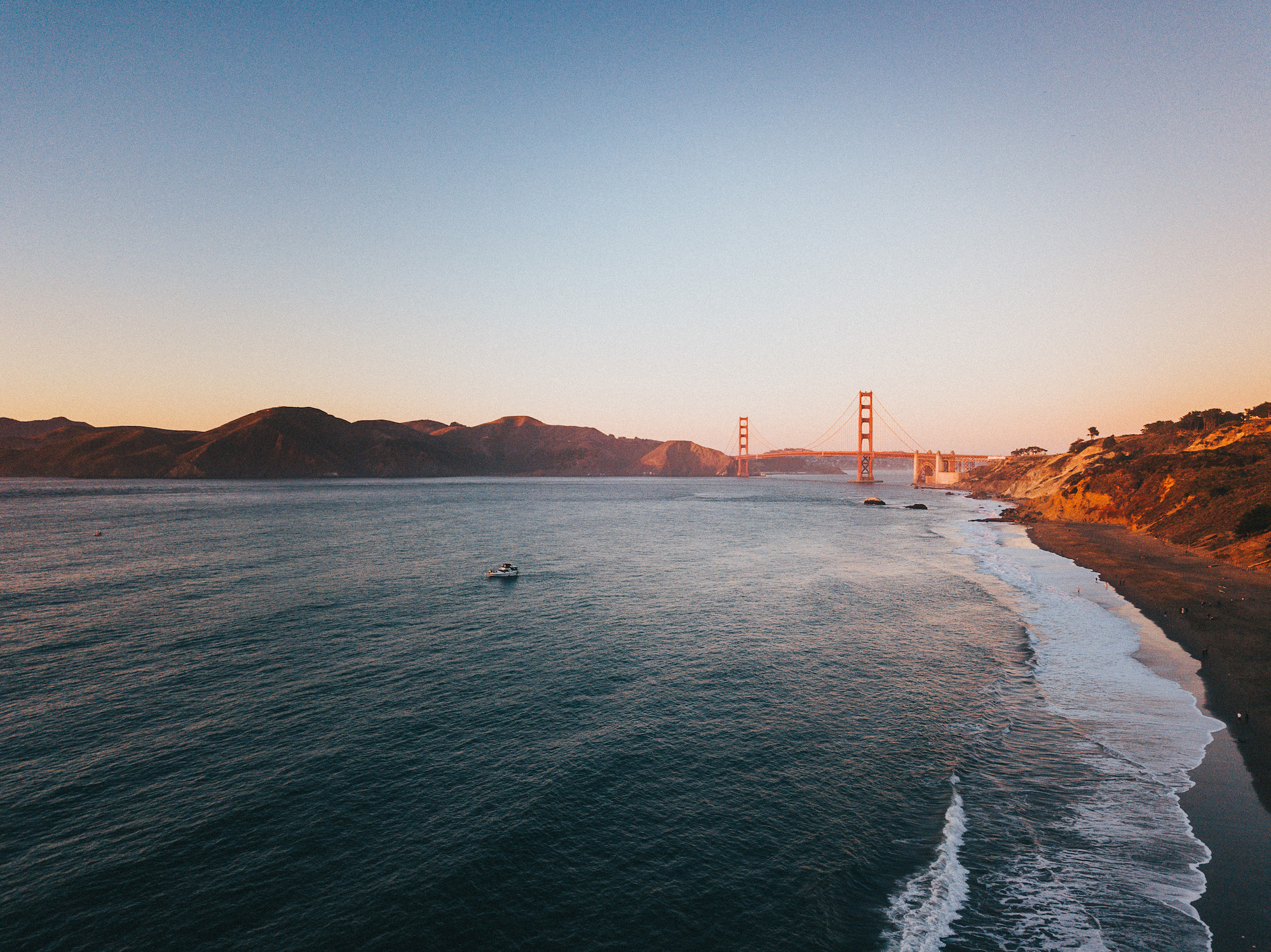
What is Aerial Photography? Aerial photography is photography taken from an aircraft or drone, usually from a high vantage point.
Whether you’re an experienced hobbyist or have been running your own photography business for a while, you might have wondered whether aerial photography is right for you.
As drone technology improves, and it’s becoming easier to shoot stunning photographs remotely, many photographers like you are starting to expand into this discipline.
Aerial Photography: A Quick History
While aerial photography might seem like a new trend, the discipline dates back to 1858, with the first aerial photograph in the world picturing Paris, France. However, the oldest surviving aerial photograph is of Boston in 1860.
Over time, photographers experimented with balloons, kites, and early aircraft for their photography until the outbreak of the First World War, during which aerial photography became vital to tracking enemy movement. This led aerial cameras to drastically increase in size, quality, and focal power. However, aerial reconnaissance was slow, which led to the British army mounting cameras on Spitfires to avoid detection.
The first commercial aerial photography company in the world was Aerofilms Ltd, which was founded in 1919 to shoot photographs for surveys and mapping. This company would go on to pioneer the practice of Photogrammetry.
Uses of Aerial Photography
Aerial photography has a variety of commercial uses in cartography, archaeology, land surveying, power line inspections, environmental studies, conveyancing, and more. It’s also widely used in the film industry to survey potential shooting locations.
Common Types of Aerial Photography
Oblique
These are the aerial photographs people are most familiar with, as they’re taken at an angle. Low oblique refers to angles closest to ground level, with high oblique being closer to vertical aerial photography.
Vertical
Vertical photographs are taken looking directly down at a subject and are commonly used in photogrammetry.
Orthophotos
In some cases, vertical photographs are combined and manipulated to create a navigable map, such as that you’d find on Google Earth.
Combinations
Aerial photographs can be combined in other ways, such as:
Panoramas
Several shots from one location, but taken at different angles, are fused together to create a “wide-angle” shot.
Stereo Photography
This technique takes multiple images from different angles of the same subject to create a 3D image.
Pictometry
Using five mounted cameras, this technique takes four low oblique shots and a vertical shot to create a single image.
Aerial Photography Regulations
Depending on where you are in the world there are numerous regulations to keep in mind. Most of these regulations cover drone use. Common regulations include:
- The pilot must keep visual contact with the drone at all times;
- The drone cannot be flown over certain protected areas,
- You might need a license to operate commercially, fly a drone, or pilot a drone over a certain weight threshold.

Aerial Photographer Uses Unique Perspective in Conceptual Photography Series
Award-winning aerial photographer Brad Walls has taken to the skies once again and returned with an imaginative conceptual photography series. ...

DJI Mavic Air 2S Review | The Drone Experience Everyone Should Have
Just when you thought DJI was done innovating and changing the landscape for creators, they release, I believe to be, ...

Aerial Photography Series | The Beauty of Synchronized Swimming From Above
Here's an inside look at how Brad Walls combined passion and planning to create this incredible aerial photography series of synchronized swimming.

DJI Mavic Air 2 Review | The Easiest Flight Experience You’ll Ever Have
The DJI Mavic line of drones is one of the coolest, (In my opinion), additions to the lineup of UAVs ...

DJI Reinvents The Drone Flying Experience With The DJI FPV
Breakthrough Drone Technology Offers Immersive, Cinematic Flight Experience And Intuitive New Single-Handed Motion Controller

Sony Unveils The Airpeak Drone at CES 2021 – The Smallest Drone Capable Of Carrying An Alpha Camera System
The Airpeak Drone from Sony transforms the sky into an infinite creative playground!

DJI Added to “Economic Blacklist” in the United States
As if tensions could get any more on edge, today it seems that DJI has found itself blacklisted by the ...

DJI Mini 2 Review | Mini But Mighty
DJI has once again created the most convenient and innovative camera companion for travelers and creators. There's a reason why the best things come in small packages.

Aerial Photographer Captures Ballet From A Different Perspective in Stunning New Collection
In the art and photography world, you often hear the saying that “perspective is everything”, and this is especially the ...

Droneception – How to Create Mind-Bending Drone Photos
From inception-like landscape images to mind-blowing and super unique selfies, in this video the COOPH photographers share their most creative ...

DJI Makes Sweeping Cuts To Their Corporate and Consumer Workforce
One of the world’s largest Drone and Gimbal making companies have made some massive layoffs during the Covid-19 Pandemic. Reported ...

Three Photo Tips & Tricks To Take Your Portraits To New Heights With Mango Street
In this video, the Mango Street team take some Vanity Fair inspired socially-distanced portraits of their model Kyra with a DJI Mavic Mini 2.